The Goad Fire Insurance Maps of Paddington Basin
 |
||
| Whole Map | Full Size | Full Size Map in New Window |
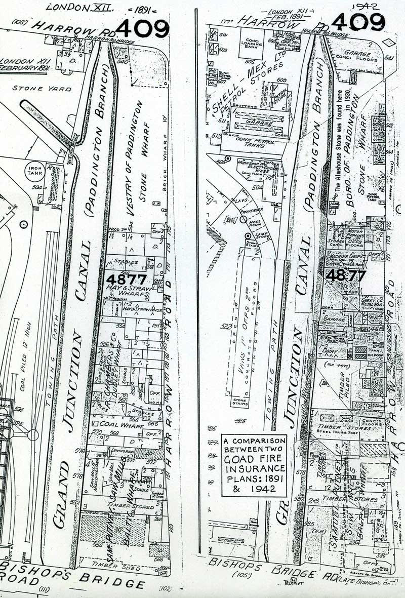
The 1891 Goad Fire Insurance Plan shows that No 175 was the Vestry of Paddington Stone Wharf. The 1942 Goad Plan calls it the Borough of Paddington Stone Wharf. The two Plans show the same layout, but with changes of use.
The Explanations of Signs on the Goad Maps
The Goad Fire Insurance Plans were not sold to the public, but were hired out in atlases to interested organizations like insurance companies and local authorities.
The Goad plans were revised regularly. New buildings were re-surveyed about every five years, the atlases were withdrawn and the corrections pasted on. The 1891 Plan appears to be a complete drawing, while the 1942 version is covered in irregularly shaped patches. If one could remove the patches there would be earlier plans below, but one cannot do this. The maps are too rare and delicate to be maltreated in this way. In any case, the individual patches are not dated so one would be little the wiser. However it may be possible for anyone to find other copies ofa particular area with different dates, in other libraries, and so build up a sequence.
As an example, two similar stretches along the Paddington Wharves for 1891 and 1942, have been printed side by side for comparison.
These maps are a treasure trove of information to anyone interested in Industrial History anywhere in the old British Empire. They are as important in the History of India or Australia, as they are in Britain because Goad, who had his offices on Crouch End, made regular surveys of docks, canals, etc all over this quarter of the Globe.
14
