History of the Site of Stoke Newington Secondary School
from 1800 to 1936
The Clissold Road Area
In 1800 the whole district was still open country, with scattered farms and herds of dairy cattle. Church Street joined Stoke Newington High Street and Green Lanes in one gravel track. There were no other roads, just footpaths. Church Walk was a bridle path which joined the villages of Newington Green and St Mary's Church. Albion Road had not yet been built.


 1800 Milne Land Usage Map showing Church Path (Church Walk) as a dotted line. |
1800 Milne's Land Usage MapMilne's Land Usage Map shows how the different fields were used at that period. This was the first Lonon Land Use Map and showed this by tiny letters in the corners of the fields and by colour. The London Topographical Edition is a revelation London in 1800
|
|||||||||||||||||||||
This is part of the first map to show how fields around London were used. There area only four colours on this part of the map, but there were many other land uses elsewhere. Stoke Newington was a rural area, with London far away, as if in another world. The Green fields were meadows; Yellow ones were arable; growing perhaps corn or turnips; Pink fields were paddocks (gentlemen's estates). The houses and gardens along Church Street and Newington Green are marked in Black Lines
The future site of Stoke Newington Secondary School must have been in the field with the small 'm' (for meadow), north east of the large M. and this part of Church Path is now part of the school grounds. This field is coloured pink in the 1814 map.
Letting off Land for Building
Landlords wanted to lease land for development, but builders and developers wanted long leases.At that time landlords could give only short leases of thirty years or less. To let leases for longer than this required a special Act of Parliament. This 1814 Prebendary map was made for the Act. The land belonged to St Paul's Cathedral and the vicars who held it for the Cathedral were Prebendaries (hence Prebendary Map). This piece shows the lower two thirds of the map.

1814 Prebendary Map of Church Street and the South of Stoke Newington,
down to Newington Green
Future Stoke Newington School Sites
The future sites of St Mary's and William Patten Primary School were in the High Street.
The future site of Stoke Newington Secondary School was in the Vicar of St Mary's Glebe Field (shown in Pink).
The future site of Betty Laywood School was in the bottom left hand corner of the Glebe Field.
The future site of Grasmere Primary School was in 'Parish of' field. This was part of Hornsey Removed (Lighter Yellow) which was administered by Hornsey at that time.
Engraving by Bewick |
|

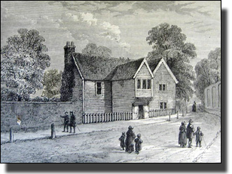
The Vicar of St Mary's lived in the old wooden Rectory on the corner of Church Street and Church Walk. This was a weather-boarded house with a high, over-sailing window which gave a fine view of everything going on in the road. Proust's Aunt Leonie would have been at home in that room, keeping an eye on all her neighbours.
As mentioned above, the Vicar had a farm on the Glebe Field which he ran as a Home Farm, or rented out to a tenant farmer.

(Photograph by permission of Hackney Archive)
The Old Rectory on the 1846 Allerton Tithe Map
The Old Rectory was the red building on plot 662. The red is the footprint of the house and therefore does not show the over-sailing look-out window.
Albion Road had been built by 1846, but the Glebe Field was still a farm. Church Path, the old bridle path linking the villages of Newington Green and Stoke Newington, is marked in blue on the Tithe Map. This path was hundreds, perhaps thousands of years old, and ran along the edge of the Vicar's Glebe Field.
*****
In 1855, the Vicar of St Mary's gave a lecture which he later published. In this he saw the houses of London moving ever closer to Stoke Newington each year. In America, he said, such was the speed of advance that pioneers moved to the Frontier and, only a year later, found themselves fifteen miles from the New Frontier.
In the sixty years after this lecture the old Cities of London and Westminster were rebuilt. Everywhere there were new railway stations, new sewers, and new roads. Hundreds of navies dug tunnels: millions of bricks were burnt and laid. London turned into a new Wild West.
There were new roads cutting diagonally through old slums. These had festered for centuries, more and more overcrowded, more and more unhealthy. Hundreds of houses were demolished and their inhabitants were scattered to the wind, with no place to go. The air, the noise, the stench, all made London such an obnoxious places to live in, that nine tenths of the population fled to along the new railway lines to the suburbs. Old Stoke Newington estates were soon covered with bricks and mortar. By 1914 the whole of Stoke Newington had been completely transformed. Stoke Newington became a suburb on the fringe of London. Beyond there were still pasture fields, but Stoke Newington's cattle-pastures had gone. The following maps reflect this.
The important book on this period is The London Building World, 1860-1880, by John Summerson’s
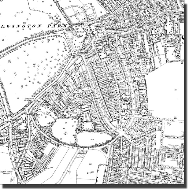
1868 Ordnance Survey map of the Betty Layward and Stoke Newington School sites.
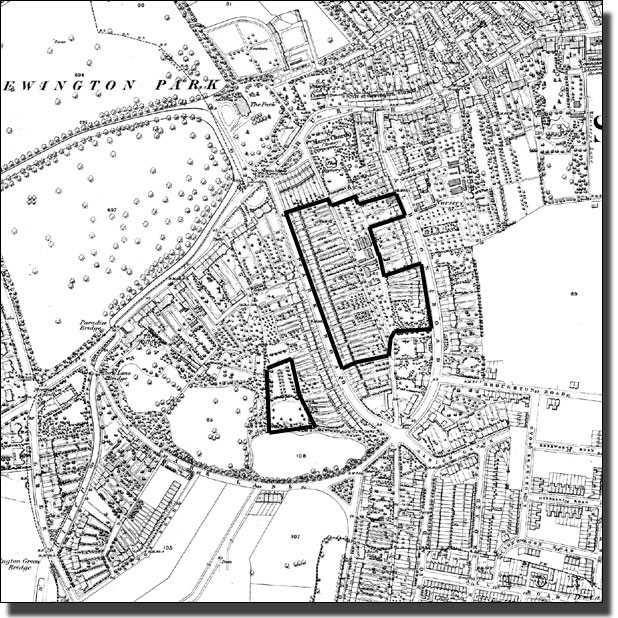
The sites of Stoke Newington School and Betty Layward School
set out on the 1869 map
By this date Clissold Road had been built across the old Glebe Field.

in 1873 Clisold Road was called Park Road and Clissold Crescent was called Park Lane. These names were so common all over the country that the Post Office found it difficult to deliver letters correctly. It demanded changes in street names and so our new names were invented.
The new Clissold Road had to curve round at the southern end because the huge estate running all along Park Road (now Clissold Crescent) was the property of Mr Alexander. Instead of continuing straight south, Clissold Road had tocurve. It cut both Albion Road and Church Walk. Then, in 1891 Mr Alexander died, his estate was sold and the next two Ordnance Survey maps of 1894 and 1913 showed what happened.
| Charles Booth (not to be confused with General Booth of the Salvation Army) was a wealthy business man who refused to believe that a million Londoners lived in 'great poverty', as radical politicians claimed. He started a long survey to prove them wrong, the first really careful survey of how people lived and worked. He found in the end that the position was even worse than he had been told. | |||||||||||||||||
 Part of Map Descriptive of London Poverty, 1888-89 |
|
||||||||||||||||
This was a very prosperous corner of land. The houses facing the Park were in a Millionaires' Row, with at least three servants and houses worth £100 a year. Clissold Road and Albion Road were ‘Well Off' with at least one servant. The houses which had just been built were Pink, were ‘Solid Comfort'- regular weekly wage – the non-commissioned officers of the industrial world (foremen and sub-managers). It is no surprise that the first Peabody Buildings, to house the very poor, were built in an area of Blue, Bark Blue and Black. The poorer grades of people were nowhere near this area. There were a few tiny pockets of Light and Dark Blue near Newington Green, while Essex Road was full of Blue and even Black.
 The Booth Poverty Map, 1889. of Essex Road |
Here was a dense concentration of squalid and unhealthy houses next to comfortable people. The health risks affected them all and the dangerous housing had to be cleared. This is where the Philanthropic Housing reformers concentrated their work. There was nothing remotely like this in comfortable Stoke Newington at that time. |
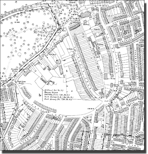
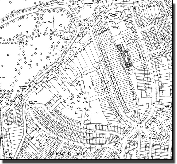
The1894 Ordnance Survey map of the area
By 1894 the huge estate along Park Lane (now called Clissold Crescent) had been sold. The area had been cleared, the trees felled and the first houses were appearing.
The1913 Ordnance Survey map of the area
The map shows the area fully built up, including the Albion Parade Shopping Parade on both sides of the road. It would stay like this until the Second World War.
Booth would have coloured all the new houses in Pink.
The map shows the area fully built up, including the Albion Parade Shopping Parade on both sides of the road. It would stay like this until the Second World War.

1936 Map
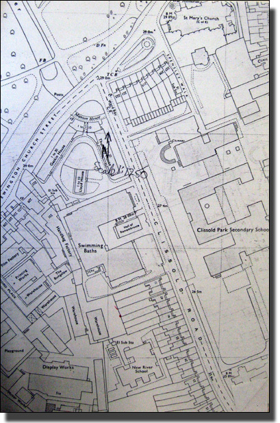
The plan of Clissold School Site which was extended when Stoke Newington School was created
At this time the New River School was on part of the present Betty Layward School site.
++ The date is wrong REMOVE CAPTION AND SUBSTITUTE
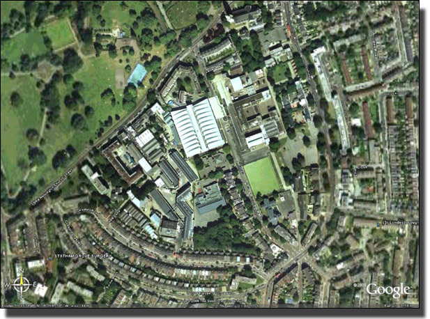
Google Map
The Aerial Site Map of Stoke Newington School and Betty Layward School sites. The Swimming Bath and Football Pitch show up clearly. Betty Layward School is blue/greyin colour, with the wood backing on to Carysfort Road.