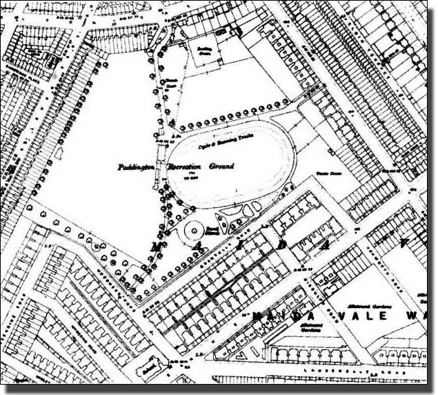
The 1913 Ordnance Survey map showing the ground surrounded by housing.
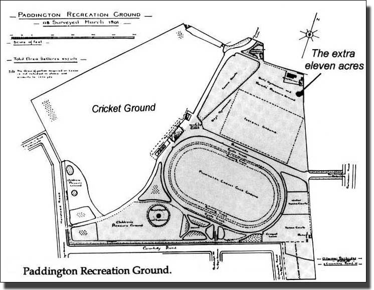
Compare this with the Boundary Map of 1900 on page 153.
The Recreation Ground today
|
The 1913 Ordnance Survey map showing the ground surrounded by housing. The Recreation Ground today |
