In May 1997 Farrell & Partners produced a Paddington Basin Master Plan to revitalize the neglected waterfront area which 'lacked public activity, permeability and a sense of place'.
For 200 years Paddington Basin had blocked the way in all directions. It was a place of work. Only those employed there had access, while everyone else had to walk round. When the canal trade collapsed it was still a barrier. In 1970 Westway sliced through the area, turning Paddington Green into a motorway nightmare, inhuman and dangerous. Now Paddington Basin was to become the hub of pedestrian life, uniting a district long chopped into separate pieces.
It would be possible to enter the basin from Praed Street and walk on either side of the Basin to Little Venice and from there to Kilburn or St John's Wood. One would cross the Basin from St Mary's Church, across Harrow Road by pedestrian crossings, under Westway, down a refurbish Hermitage Street, across the canal footbridge, to Praed Street and Paddington Station. It would be the way to the shops in Edgware Road , Paddington Railway Station, the Tube and St Mary' Hospital. It would also provide miles of car-free tow path for walking and exercise.
The Master Plan was designed to be robust and appropriate to canal side environments, with the towpath in York Stone and Granite sets, attractive and hard wearing.

West Quay, in Praed Street
This is the impressive entrance building to the Basin from Praed Street.
No longer is the Basin cut off from the world.

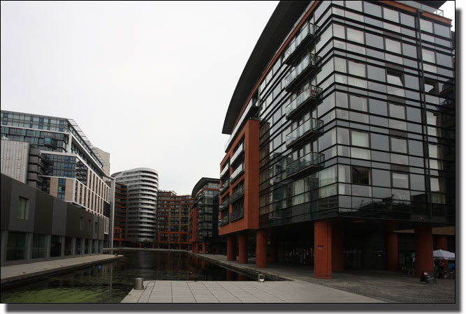
This is the modern Head of the Basin with Praed Street to the right behind the buildings and North Wharf Road behind to the left. This is the main entrance to the Basin, but there are ways in and out further down the Basin to the right to Praed Street and via the footbridge to the left to North Wharf Road.

The Modern Head of Paddington Basin
A reminder of the same site in years gone by
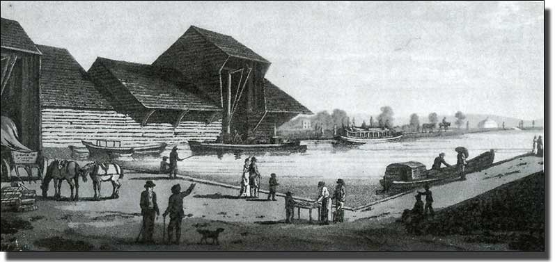
The First Barge-loading Building in 1801 in an open basin
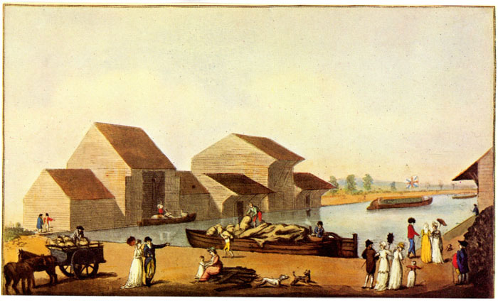
Paddington Canal Basin, drawn by Henry Milbournd and engraved by Joseph Jeakes.
This is an engraving of the same site in 1801 when the Canal first reached Paddington and linked the Industries of Birmingham and the Midlands to London . The loading building was the only construction on the Basin at that time.

The original Loading Bay surrounded by dereliction,
photographed from the Metropole Hotel in 1990
This is a modern picture (circa 1990) of the Loading Bay which was seen in the earliest engravings of Paddington Basin . It was listed as an building of historical interest in about 1990. The photograph, taken from an upper window in the Metropole Hotel, shows the old loading building before demolition and storage. The loading bay was preserved for later use.

Paddington Basin painted by Algernon Newton between the Wars
This picture shows the Basin at a time when it was surrounded by warehouses and factories. It appears to be peaceful but at this time it was full of activity. The picture, which is in the Brighton Pavilion, is enormous.
Changes to the Basin after 1990
The Basin from the Metropole Hotel in 1990
Paddington Basin Building, Demolished in 1999
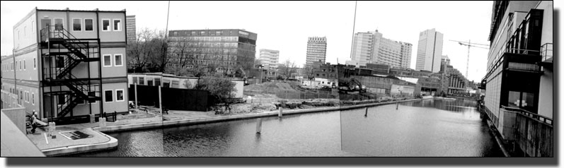
By 1999 all the buildings at the head of Paddington Basin , from Harbet Road ( Irongate Wharf Road ) to the St. Mary's Hospital car park in Praed Street , had been totally demolished. The site was protected by hoardings decorated with pictures advertising the new flats which Regalian, the development company, planned to erect in the next few years. The site guard, sitting there in a portacabin, the sole commander of absolutely nothing, gave me permission to go in. For an hour I was free to wander on the site with the Goad Insurance map of 1891 (below) in my hand.
I was reminded of a time when the archaeologist Flinders Petrie, came to a site which had been leveled and destroyed by robbers. Anything saleable had been stolen and the rest smashed to pieces. He collected the pottery fragments, as valuable to him for dating purposes as complete pots, and swept the site. There he found the original foundation lines, set out by the builders millennia earlier. Using these and with his knowledge of mud brick buildings elsewhere and the dimensions of foundations required for walls of different heights, Petrie was able to calculate these wall heights and draw the lost buildings.
The Basin site was equally bare, mostly leveled and with a few dangerous pits boarded over for safety. The roof of the old loading shed had been carefully dismantled and stored, ready for re-erection at the far end of the Basin as part of a new Facilities Building . All other buildings had suffered a rougher fate - bulldozed to rubble and carried away.
I could make out the walls of buildings and the cobbles of the roadway from Praed Street to the Basin, shown beside Phillips Mills and Co. on the Goad map. Floor levels varied in height, with connecting slopes running up and down. Some parts were in smooth concrete, painted red or pale grey. One could imagine how these floors had been swept daily, scored by the wheels of trolleys, repainted and cared for by generations of people, perhaps even a line of fathers and sons. Now the whole area would become the anonymous foundations for new buildings and the Basin be converted from a stretch of stagnant water into a boating marina and restaurant complex.
The Basin on May 2001
Further down the Basin.
A view from the footbridge at the other end of the Basin. The picture shows the beginning of the Boarded Walk which the developers built in front of St Mary's Hospital.

The ingenious footbridge built to cross the narrow canal way to the inner basin.
When a barge wishes to pass the bridge stands vertical to clear the way.
++TRY TO OBTAIN A PICTURE WITH THE BRIDGE VERTICAL

Two other views of the footbridge.
(The second one replaces the first when you move
your mouse over the image above)

The Metropole Hotel Extension seen fron the Car Pak at the end of North Eharf Road.

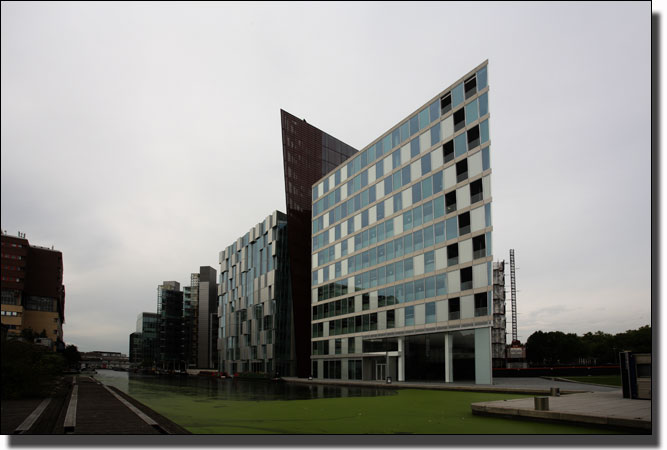
Looking down the Basin showin the corner of the triangular building.
Behind the first building is a vertical wall which separates out the other triangular buildings.
++FIND THE MODERN STREET PLAN SHOWING THE LAYOUT OF THESE BUILDINGS.
A Wider View of the side of the Basin

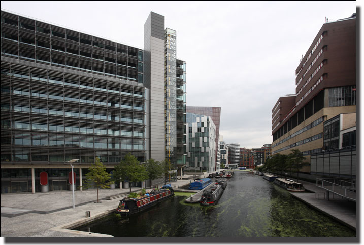
Straight dow the Basin with St Mary's Gospital on the left.
The still water of the canal encourages the growth of a algea bloom at certain times of year.
(++Second use of image)

Two views further down the Basin
(The second one replaces the first when you move
your mouse over the image above)
Views from the Footbridge
Looking Up the Basin from the Footbridge.
(Two views again)
In the distance on the left are the triangular buildings we have seen with a barge dock and a triangular concoures planted with trees. On the right is St Mary's Hospital with its boarded Walk and trees planted in large concrete plots.
++which to use?
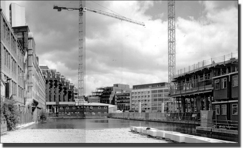
This bank under construction in about 1990
withe the developers portacabins on the left.


St Mary's Hospital across the Basin with its boarded walk
and trees planted in large concrete plots.
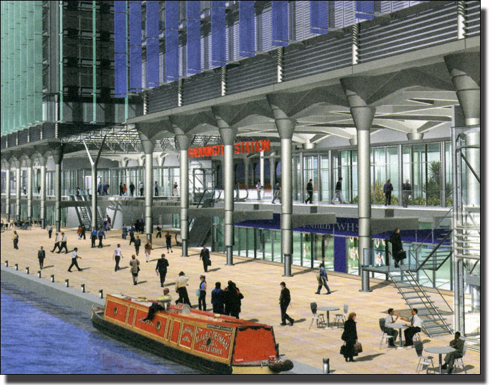
An artist's impression of the new canal-side entrance to Paddington Station
and the Metropolitan Underground Station down below
The barge is a reminder that years ago barge children used to lie on the floor of the barge to hear the trains pass below. Now they could buy a platform ticket.
++FIND PICTURES OF THE ACTUAL FOOTBRIDGE
Views from the Footbridge looking the
other way towards the Entrance Canal.

The Point at the entrance to the basin with a barge bay and a boarded access walk.

The Entrance Canal

The Point at the entrance to the Basin from the opposite direction.
(The footbridge is on the right)

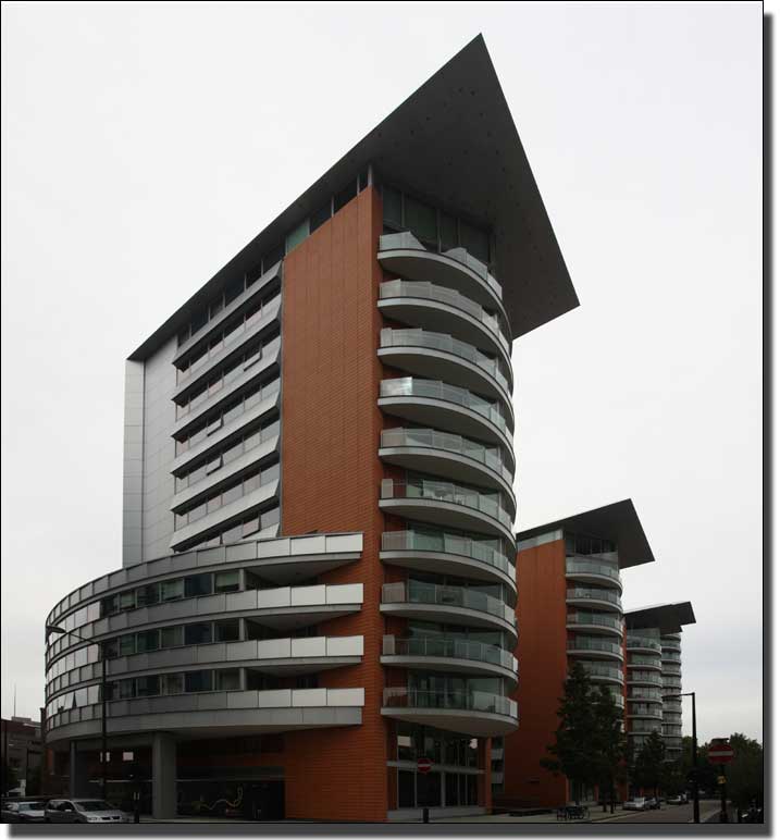
The original artist's impression of The Point. The final building has more brick
and less glass but the design and shape are identical.

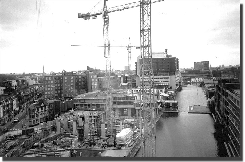
The Point under Construction
This is a reminder of the construction of The Point in 1999. The montage shows the site when the concrete surrounding wall had been built and the brilliant yellow sand below exposed. Millions of years ago this sand was part of the huge delta of the River Thames where dinosaurs used to roam. It stretched from Primrose Hill to Thornton Heath and was like the Delta of the Nile : an immense area of sand and alluvium, full of river tributaries which changed course all the time. This yellow sand was sold immediately to the building industry and became concrete within weeks.

The Entrance Canal
This is the entrance to the Basin from Little Venice and shows how the original canal had to turn left in order to find a level piece of ground for the Basin so that the water did not pour out of one corner. The buildings on the opposite bank were original Wharf buildings, horse stables etc.

The other bank shows a modern Hospital Block with
its boarded walk to give pedestrian access.
We now leave the Basin via the footbridge into North Wharf Road
The New Peabody flats in Hermitage Street

An artist's impression of the new Peabody flats in Hermitage Street
