Westborne, or Westbury Farm, in 1816
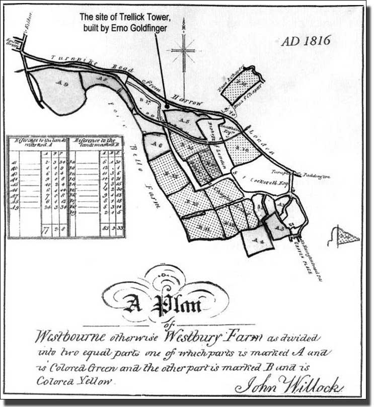
The plan of Westbourne (or Westbury) Farm comes from the 1816 Act of Parliament which divided the farm in two. The plan has been reduced and re-orientated to fit the page and to make it easier to compare with the Gutch map of the same area.
A house on Westbourne Farm, perhaps even the farmhouse itself, was occupied by the actress Sarah Siddons from April 1805 to Autumn 1817, while her brother Charles Kemble lived in a smaller house nearby for part of the time.1
Sarah Siddons' house stood 84 yards south of the canal, on ground by The Spotted Dog public house, Nos. 12-18 Cirencester Street. The Spotted Dog, far older than other buildings, is marked on John Rocque's map of 1746.
The Canal had reached Paddington in 1801, so the fields referred to on this map had been divided by then. This map had to do with the dividing of the farm, not the cutting of the canal.
Westbury Farm ran along Harrow Road, with two small pieces completely detached from the rest. When the canal was routed through the farm, some fields were cut in half and renamed Rum Hawes and Slip (North Part) and Rum Hawes and Slip (South Part) etc.
By the time this map was made the Regent’s Canal was being cut from Paddington to Whitechapel and had reached as far as Camden Town. Once again the Company was short of money.
See The Growth of Camden Town, by Jack Whitehead.
Footnote
- Paddington Society Newsletters No. 28, Jan 1962 and No. 55, Dec 1964.
